Nestled close to Pioneer Trail in South Lake Tahoe, the Cold Creek Trail offers a tranquil escape into nature, perfect for hikers and mountain bikers alike. This multi-use path serves as a connector to a network of trails, inviting you to delve deeper into the mountainous landscape.
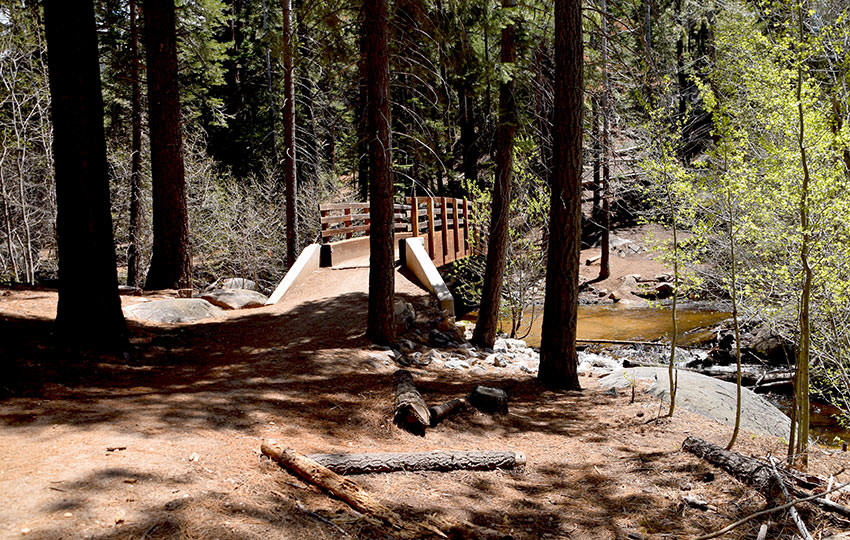 Wooden bridge over Cold Creek surrounded by lush greenery
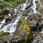
While the Cold Creek Trail might not boast panoramic vistas, its unique charm lies in the immersive experience it provides. Almost immediately after stepping onto the trail, the towering mountain walls on both sides create a sense of seclusion, effectively distancing you from the nearby civilization along Pioneer Trail. This quick immersion into nature is one of the trail’s most appealing features.
Cold Creek Trail: Quick Stats for Your Hike Near Pioneer Trail
Before you embark on your exploration of Cold Creek Trail, here’s a snapshot of what to expect:
- Location: South Lake Tahoe, easily accessible from Pioneer Trail
- Hike Type: Ideal for Short Day Hikes
- Total Distance: Approximately 2.5 miles
- Elevation Gain: Around 300 feet
- Peak Elevation: Reaching 6,565 feet
- Trail Surface: Predominantly hard-packed sand
For those seeking more short and easy hiking options around South Lake Tahoe, numerous trails complement the Cold Creek experience.
Planning Your Visit to Cold Creek Trail off Pioneer Trail
To ensure a smooth and enjoyable hike, keep these points in mind when planning your trip to Cold Creek Trail:
- Parking: Parking is conveniently located near the water substation gate along Pioneer Trail. Please be mindful not to obstruct the gate access.
- Pet Policy: Dogs are welcome on the trail, provided they are leashed and cleaned up after, helping maintain the trail’s pristine condition.
- Leave No Trace: Practice Leave No Trace principles to preserve the natural beauty of Cold Creek Trail for everyone.
- Trail Navigation: Signage can be sparse in the Tahoe region’s public lands. If you lose sight of a clear path, it’s best to retrace your steps to avoid getting lost.
- Weather Preparedness: Mountain weather can change rapidly. Dress in layers, bring warm clothing, and carry sufficient food and water.
- Safety First: Inform someone about your hiking plans and expected return time. This precaution is crucial for your safety in case of unexpected delays.
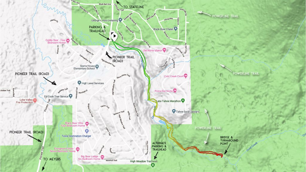 Detailed map of Cold Creek Trail highlighting parking and trail route
Click on the map above to enlarge for printing or detailed viewing. This map serves as a general guide for the Cold Creek Hiking Trail. Always carry a topographic map and compass for backcountry navigation.
Directions to Cold Creek Trailhead from Pioneer Trail
Accessing the Cold Creek Trailhead is straightforward from Pioneer Trail.
Trailhead Location: The trailhead is situated at the water substation on Pioneer Trail, positioned between Cold Creek Trail road and High Meadow Trail road. From Highway 50 in Meyers, the substation is about 4.5 miles away, and approximately 3.25 miles from Highway 50 near Stateline. Parking at this location is limited.
Alternative Parking: For an alternative, especially if the main parking is full, head southwest on High Meadow Trail road from the water substation. Parking is available at the end of High Meadow Trail road, near another trailhead access point. Again, ensure you are not blocking any gates.
Choosing the High Meadow Trail access point significantly shortens the Cold Creek hike, offering a different experience. However, for the hike described here, the water substation access on Pioneer Trail is the starting point.
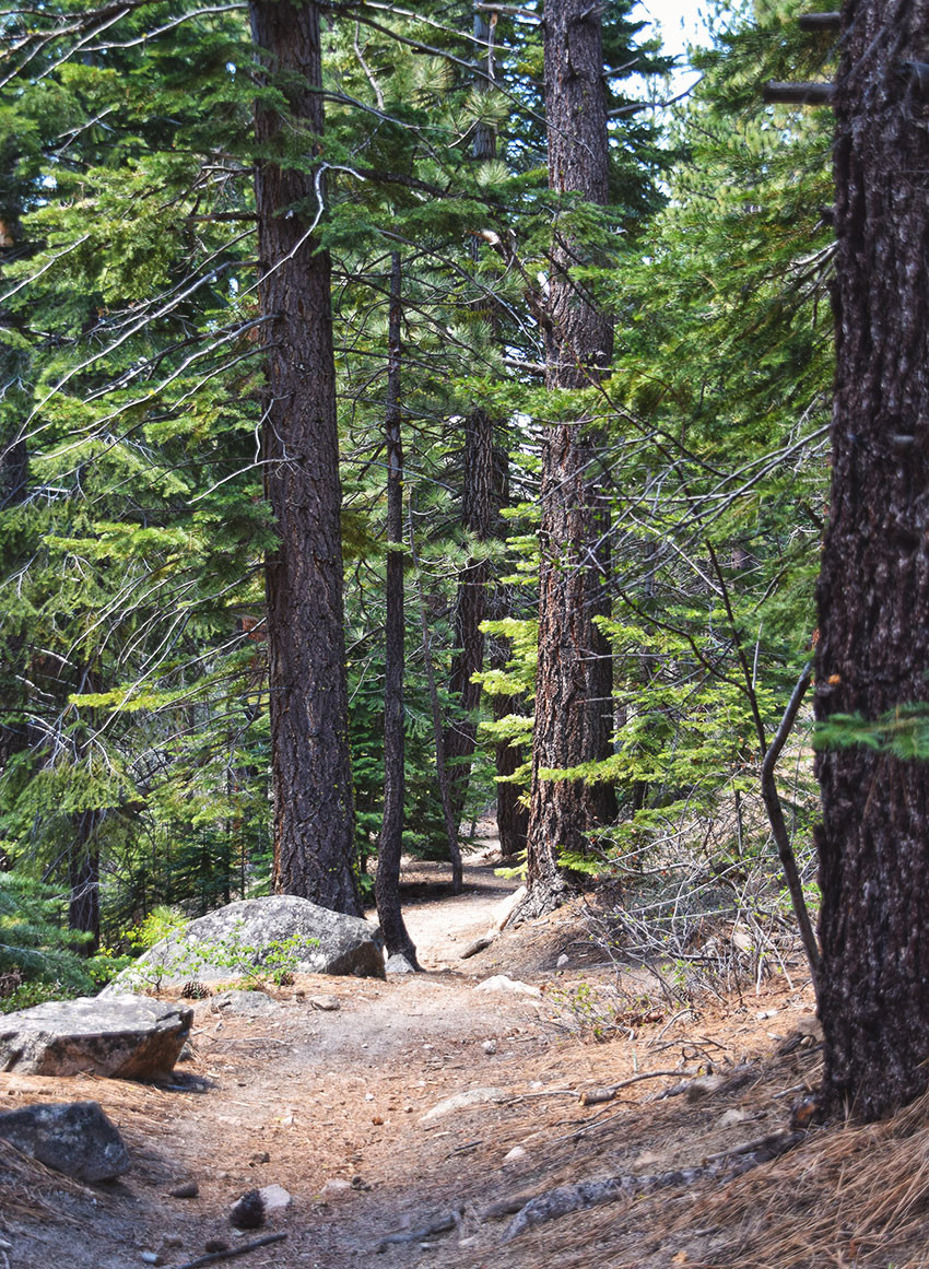
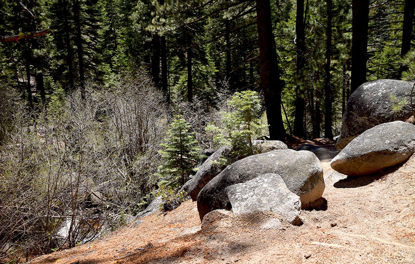 Sunlit trail through a boulder-strewn forest on Cold Creek Trail
Granite boulders dotting the Cold Creek Trail landscape, captured in May 2016.
Hiking Experience Along Cold Creek Trail
Starting Your Journey: Find the trailhead for Cold Creek Trail on Pioneer Trail at the water substation, located between Cold Creek Trail road and High Meadow Trail road.
The Cold Creek Trail ascends immediately from the substation. Be prepared for an initial uphill climb. This trail is also popular with mountain bikers, often descending at speed, so be aware of uphill bikers as you hike.
Immersive Forest Setting: As the Cold Creek Trail winds through a forested draw, expansive views are not the highlight. Instead, the trail’s charm is in its ability to make you feel miles away from civilization, despite its proximity to neighborhoods along Pioneer Trail. The natural walls of the draw effectively block out surrounding noise, enhancing the sense of wilderness.
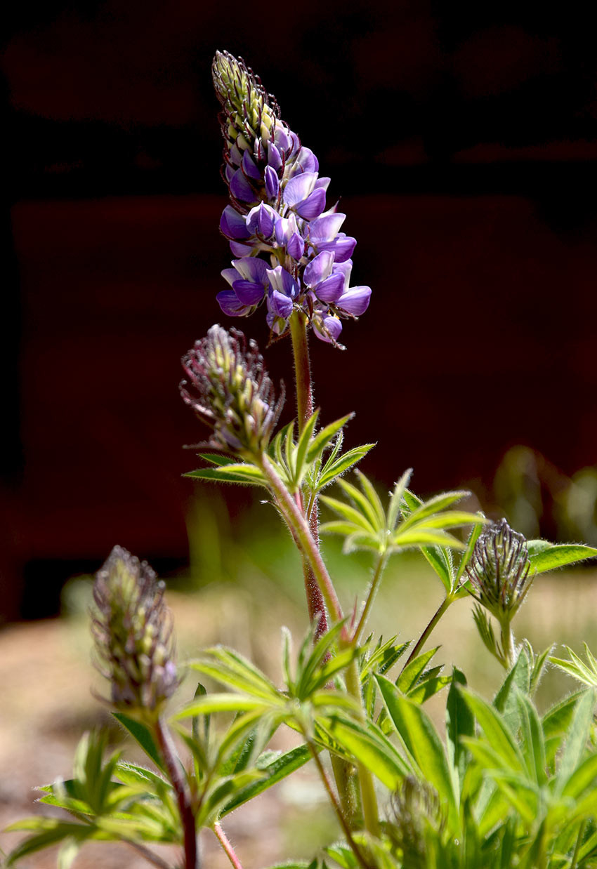 Lupine wildflowers blooming beside the Cold Creek Trail
Lupine flowers adding color to the Cold Creek Trail in May 2016.
Midpoint Bridge and Trail Junction: Approximately 1.25 miles into the hike, you’ll reach a beautifully constructed bridge crossing Cold Creek. This bridge also marks a junction with Powerline Trail and High Meadow Road. Consider exploring Powerline Trail for potential Lake Tahoe glimpses if time allows.
Winter on Cold Creek Trail: Cold Creek Trail is suitable for snowshoeing in winter. However, it’s less ideal for cross-country skiing due to granite boulders and some steep, winding sections.
 Hiker descending Cold Creek Trail through a shaded forest
Hiking back down Cold Creek Trail, enjoying the peaceful forest atmosphere.
Even without dramatic views, the simple act of spending an hour or two walking through the secluded forest along Cold Creek Trail can be incredibly rejuvenating for both mind and body. If you are near Pioneer Trail in South Lake Tahoe and looking for a quick nature escape, this trail is an excellent choice.
Share Your Cold Creek Trail Experiences!
Do you have insights, feedback, or recent trail updates for Cold Creek Trail? Please share them in the comments below to help other hikers and outdoor enthusiasts!