
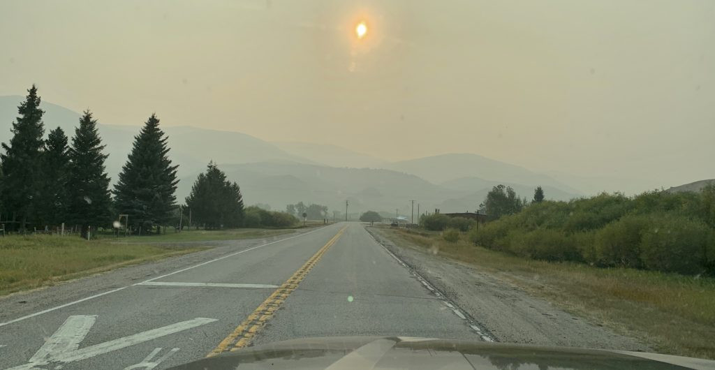
In early September 2020, as devastating wildfires engulfed the Western states, blanketing the region in unprecedented levels of smoke and prompting forest closures, we sought refuge. California and Oregon bore the brunt of the infernos, but the suffocating air quality stretched across most of the West and into Canada. For our next escape, we turned to the map, searching for a haven with fewer crowds, favorable weather, and, crucially, cleaner air. Southwest Montana’s Pioneer Mountains emerged as the ideal destination. We anticipated fewer people, promising weather conditions, and hoped for a reprieve from the pervasive smoke—a gamble anywhere west of the Rockies at that time.
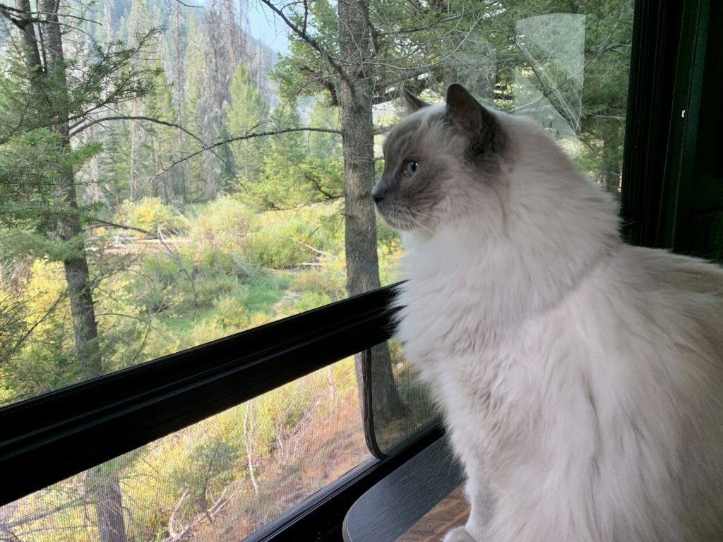 Indy enjoying the view from our campsite in the Pioneer Mountains
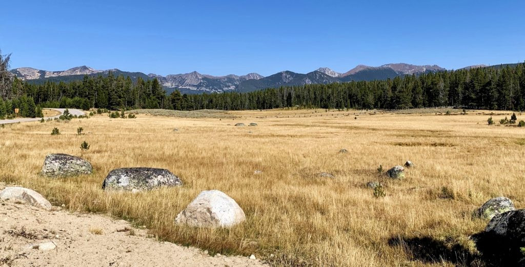
Our journey into the Pioneer Mountains led us along the breathtaking Pioneer Mountains Scenic Byway, a 49-mile route nestled within the Beaverhead-Deerlodge National Forest. This designated Pioneer Scenic Byway, guide available here, traverses the entire Pioneer Mountain Range, where imposing granite peaks soar to over 10,000 feet. This area truly offers something for everyone: from camping and hiking to horseback riding, fishing, hunting, historical exploration, rockhounding, relaxing hot springs, and even a ski resort. The Pioneers remain a relatively undiscovered treasure, promising a more tranquil mountain experience compared to Montana’s more frequented locales like Glacier National Park.
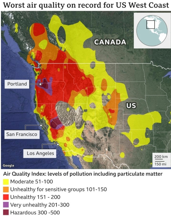 Map illustrating the widespread poor air quality across the US West Coast during the 2020 wildfires
Officially designated as a scenic byway in 1989, this route extends southward from State Highway 43 near Wise River to State Highway 278, situated between Dillon and Jackson. It’s important to note that the Pioneer scenic byway is seasonally closed from December 1st to May 15th between the Pettingill parking lot and Elkhorn Hot Springs. Its manageable length makes it an excellent day trip, while the nine conveniently located Forest Service campgrounds provide ample opportunities for extended stays amidst this natural beauty.
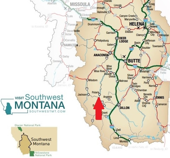 Map showing the route of the Pioneer Mountain Byway in Southwest Montana, highlighting its north-south trajectory from Wise River to Polaris
Camping Under the Big Montana Sky Along the Pioneer Scenic Byway
Whether you prefer the simplicity of a tent or the comforts of an RV, the Pioneer Mountain Scenic Byway boasts a Forest Service campground to suit your camping style. Traveling from north to south along the byway, you’ll find a variety of options including Pettengill, Fourth of July, Lodgepole, Boulder Creek, Willow, Little Joe, Mono Creek, Price Creek, and Grasshopper.
For tent campers and those with smaller RVs, we suggest Willow, Little Joe, and Mono Creek. The remaining campgrounds (excluding Pettengill) generally offer sites capable of accommodating larger setups, including our 51-foot truck and travel trailer combination. However, if you’re traveling with an exceptionally long RV, it’s wise to confirm site suitability with the Wise River Ranger Station before your arrival. As for Pettengill, it remains on our list to explore – if you’ve camped there, we’d love to hear about your experience!
 Detailed map of the Pioneer Mountain Byway highlighting campground locations and key landmarks along the route
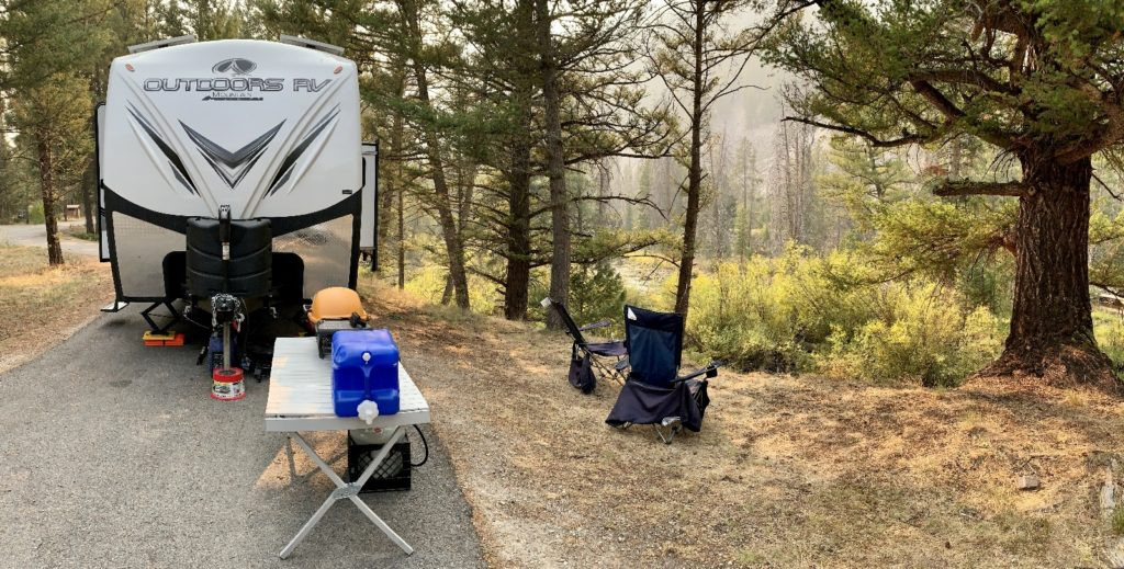
While each campground along the Pioneer scenic byway possesses its own charm, we opted for Boulder Creek Campground for our stay. Its appeal lay in the pleasant shade it offered while still allowing ample sunlight for our solar panels. We also appreciated its quieter atmosphere compared to the more bustling Lodgepole Campground. Lodgepole’s popularity likely stems from its desirable riverside campsites along the Wise River. At Boulder Creek, we secured a convenient pull-through site overlooking the Wise River, although direct river access wasn’t readily available. The campground featured paved access roads and sites, each equipped with a picnic table and fire pit. Potable water was accessible via a hand pump, and pit toilets were available, but no garbage service was provided. The camping fee was a reasonable $8 per night.
 A peaceful campsite nestled amongst trees in the Pioneer Mountains, showcasing a picnic table and fire pit
During our exploration of the Pioneer scenic byway, we noticed numerous attractive dispersed camping spots, offering free dry camping opportunities. On future visits, we intend to explore these more fully, but for this initial foray, Boulder Creek Campground proved to be an excellent choice.
 A campsite at dusk in the Pioneer Mountains, with a tent silhouetted against a smoky sunset sky
A few practical considerations for your visit to the Pioneers: ensure you stock up on supplies, particularly diesel fuel. While the Wise River Mercantile offers basic essentials, their selection is limited, and they don’t sell diesel fuel. Additionally, cell phone service and Wi-Fi are extremely scarce in this region. The strongest Verizon signal we encountered was in the parking lot of the Wise River Ranger Station.
Hiking Adventures in the Pioneer Mountains
The Pioneer Mountains are a hiker’s paradise, with trails catering to various skill levels. Many trailheads are easily accessible from the Pioneer Mountain Scenic Byway, while others can be reached via I-15 to the east. I had compiled an extensive list of high mountain lake trails to explore during our visit, but unfortunately, we only managed to hike two, and even those were marred by smoky conditions that obscured the panoramic views. It was a disappointment, as photos of Pioneer lakes reveal their breathtaking beauty. A return trip to conquer our unhiked trail list is definitely in our plans.
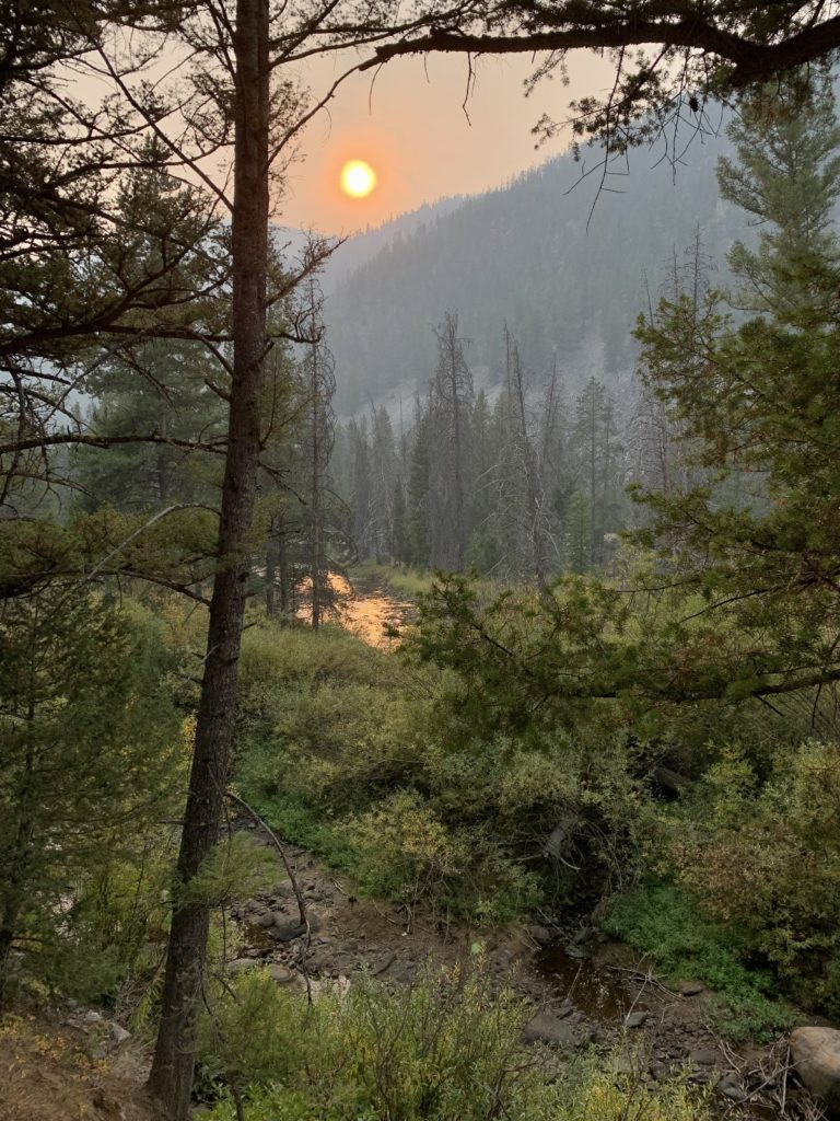
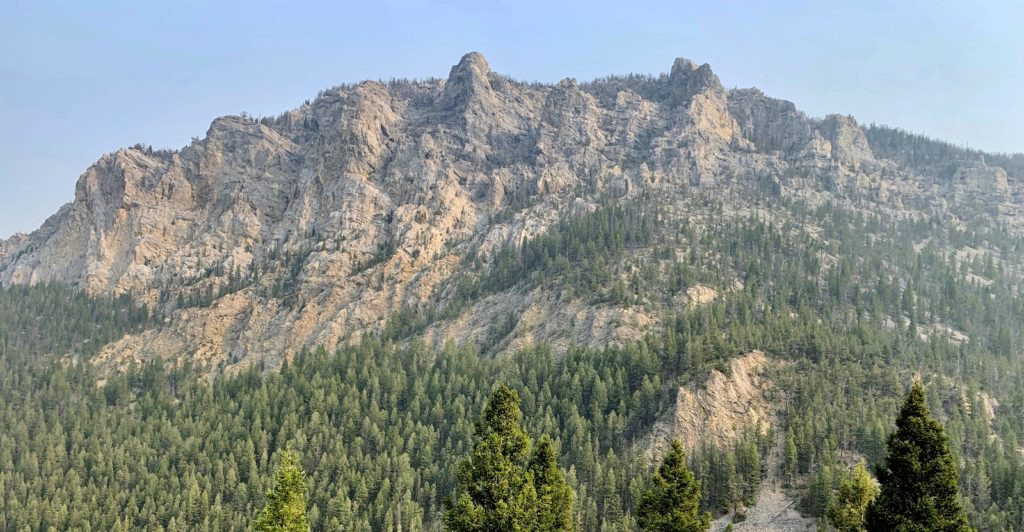
 Sawtooth Lake in the Pioneer Mountains, its beauty diminished by the pervasive wildfire smoke on a September day
Our first hike in the Pioneer Mountains was to Sawtooth Lake. From our Boulder Creek campsite, we drove south along the Pioneer scenic byway to just past the turnoff for Maverick Mountain Ski Area. We then turned east onto Clark Creek Road, following signs to the well-marked trailhead.
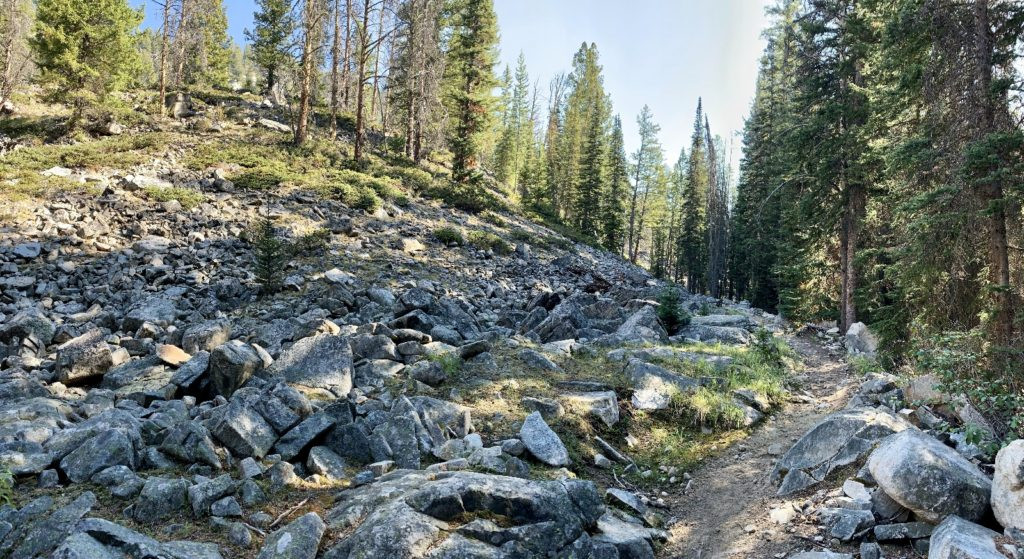
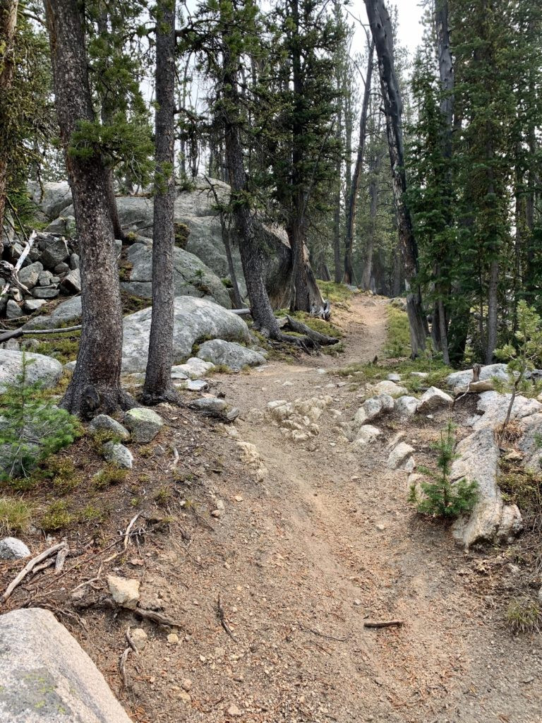
The Sawtooth Lake trail was impeccably maintained, except for a section with recent fallen trees. The initial ascent took us through an area affected by a 2003 wildfire, now regenerating with young, vibrant lodgepole pines. Shade was scarce on this initial stretch. The middle portion of the hike transitioned into a delightful and relatively flat walk alongside Clark Creek through a healthy forest. The final climb to the lake was well-graded, offering glimpses of scenic views, although these were somewhat muted by the wildfire smoke.
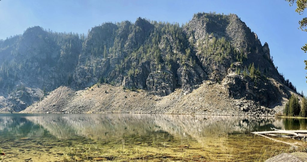
 A closer view of Sawtooth Lake, showcasing its clear waters and mountain setting, despite the smoky haze
Sawtooth Lake, at an elevation of 8,523 feet, is a stunning alpine lake framed by impressive mountain peaks. While the wildfire smoke diminished the clarity of the views, we thoroughly enjoyed our visit and would gladly hike it again on a clear day to fully appreciate its splendor. Our hike covered 7.8 miles with a total elevation gain of 1,500 feet. Trail traffic was light, with only four other groups encountered. If you’re seeking a moderately challenging hike in the Pioneer Mountains, a visit to Sawtooth Lake is highly recommended.
Our second hike led us to Grayling Lake. While Grayling Lake was geographically close to our campsite, reaching the trailhead by road was a different story. The drive was nearly two hours each way, requiring us to travel north on the Pioneer Mountain Scenic Byway to Wise River, then east on highway 43 to I-15, south to the Melrose exit, and finally 17 miles west on Trapper Creek Road (gravel) and Canyon Creek Road (dirt)—a slow, washboard-ridden, potholed adventure in itself! Along the way, we stopped at the intriguing Canyon Creek Charcoal Kilns, which deserves a separate post.
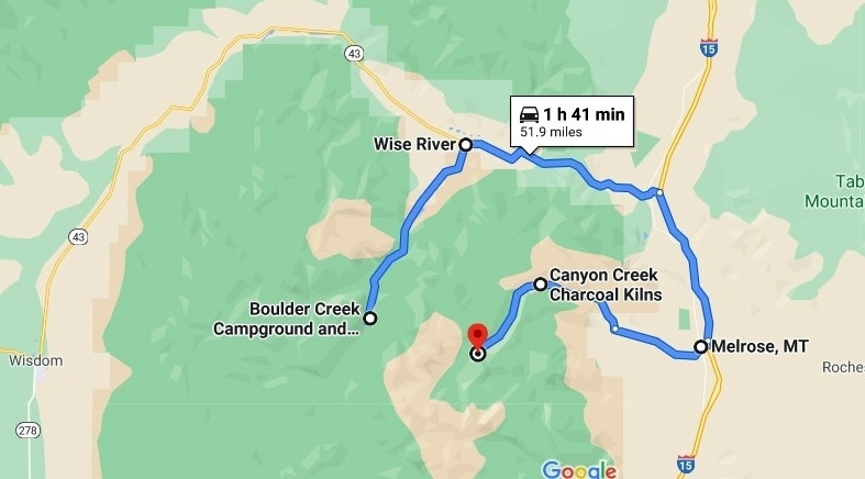 Map illustrating the longer, circuitous route required to reach the Grayling Lake trailhead from the Pioneer Mountain Byway campgrounds
Smoke conditions were still prevalent upon our arrival at the Canyon Creek Trailhead, but we commenced our hike with optimism. The trail immediately crossed Canyon Creek via a sturdy footbridge and continued at a gentle incline through the forest. Occasionally, we caught glimpses of towering mountain peaks in the distance, largely obscured by the smoke. The forest on this eastern side of the Pioneers appeared lusher than the western side.
 The gravel and dirt road leading to the Canyon Creek Trailhead, the gateway to Grayling Lake hike
At 1.75 miles, we reached a marked trail junction. The right fork led to Crescent Lake, a potential backpacking destination for the future. We took the Lion Creek Trail to the left, continuing our gentle ascent through the forest. The majority of the elevation gain occurred in the final couple of miles, via exceptionally well-designed switchbacks. We passed several viewpoints, sensing the grandeur of the surrounding mountains, but the thickening smoke limited our vistas.
 Another perspective of the switchback trail, emphasizing the steepness and the surrounding dense forest
Grayling Lake, at 8,728 feet, was breathtaking. Had it been a clear day, we suspect it would have ranked among the most spectacular lakes we’ve ever encountered. I had initially planned to continue to neighboring Lion Lake (reputedly even more stunning), but time constraints and the worsening smoke dissuaded us. We both agreed that a backpacking trip to this area is a must for the future. For this visit, we simply enjoyed a peaceful break at the Grayling outlet before our return hike.
Despite the smoky haze and obscured views during our visit, we wholeheartedly recommend the hike to Grayling Lake if you are prepared for the lengthy drive from the Pioneer scenic byway campgrounds. Our total hike was 11.6 miles with a 1,400-foot elevation gain. We only encountered two other groups, offering a truly solitary hiking experience. This area has earned a prominent spot on our bucket list, and we eagerly anticipate a future backpacking adventure here.
 Grayling Lake under smoky skies, still displaying its serene beauty despite the compromised visibility
As air quality continued to decline, we shifted our focus from hiking boots to exploring the area’s historical sites.
Beyond Hiking: Recreational Opportunities Along the Pioneer Scenic Byway
While our Pioneer Mountains trip centered on camping, hiking, and historical exploration, numerous other exceptional recreational opportunities await along the Pioneer Mountain Scenic Byway:
 A scenic viewpoint along the Pioneer Byway, showcasing the panoramic mountain vistas before the smoke haze descended
- Interpretive sites, overlooks, and picnic areas: Take your time to appreciate the byway’s well-marked sites.
- Elkhorn Hot Springs: This privately owned hot springs resort promotes itself as a “rustic getaway in the Grasshopper Valley.” They offer lodging, a restaurant, and various outdoor pools with temperatures ranging from 92 to 102 degrees Fahrenheit.
- Maverick Mountain Ski Resort: A “Montana local secret” known for its pristine, untouched powder.
- Crystal Park Mineral Collection Area: Dig for quartz crystals at this Forest Service site located directly on the byway. A vehicle fee of $5 applies.
- Big Hole River fishing: The charming community of Wise River provides river access, and several outfitters offer guided fishing excursions.
Exploring Nearby Recreational Gems
Extend your Pioneer Mountains adventure by exploring these nearby recreational highlights:
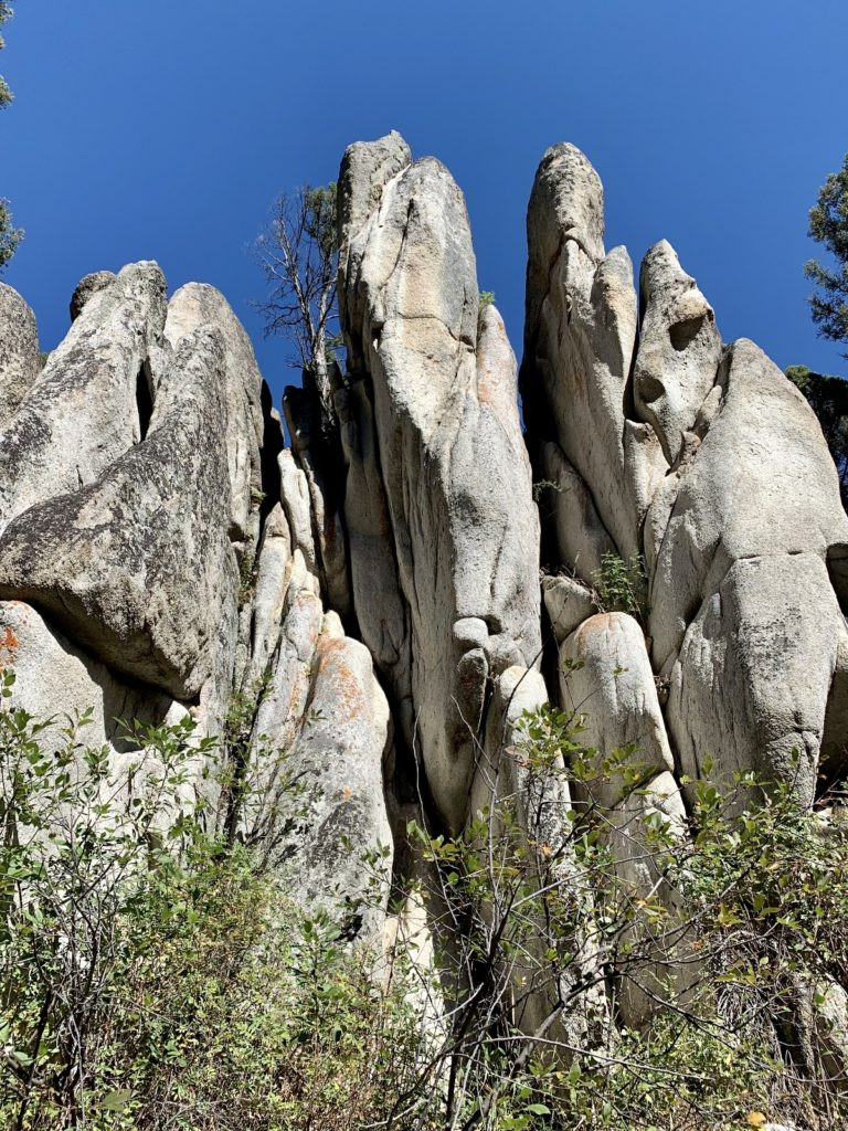 Another view of Humbug Spires, showing the trail winding through the rock formations and surrounding landscape
Essential Resources for Planning Your Pioneer Scenic Byway Trip
- This indispensable Forest Service brochure is a must-have for anyone planning a visit to the Pioneer Mountains National Scenic Byway. We also obtained valuable, up-to-date road and trail information from the helpful staff at the Wise River Ranger Station.
- Dillon and Butte are the closest full-service towns to the byway, offering a range of amenities.
Continue Your Pioneer Mountain Adventure
Stay tuned for our next post, “Montana’s Pioneer Mountains National Scenic Byway Part 2: Historical Sites,” where we’ll guide you through Coolidge Ghost Town (a byway highlight) and the Canyon Creek Charcoal Kilns.
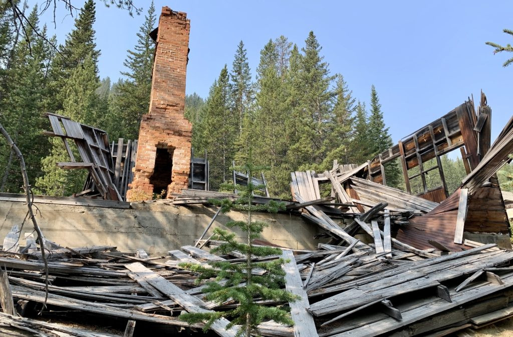 Coolidge Ghost Town, a well-preserved historic site along the Pioneer Mountain Byway