GPS technology, a cornerstone of modern navigation, offers precise location and timing services. This article from pioneer-technology.com will explore how GPS works, its evolution, and its wide-ranging applications in today’s interconnected world. Discover the innovations and possibilities that GPS technology unlocks for individuals and industries alike, enabling us to navigate and interact with the world around us more efficiently. Dive in to learn about its accuracy, components, and how it’s shaping the future of technology.
1. What Is GPS Technology?
GPS technology is a satellite-based navigation system that provides location and time information in all weather conditions, anywhere on or near the Earth where there is an unobstructed line of sight to four or more GPS satellites. GPS has revolutionized various industries, from transportation to agriculture.
1.1 What Are the Key Components of GPS Technology?
GPS technology comprises three primary segments: space, control, and user. The space segment consists of a constellation of satellites orbiting the Earth, transmitting signals containing information about their position and time. The control segment includes ground stations that monitor and maintain the satellites, ensuring their proper functioning. Finally, the user segment consists of GPS receivers, such as smartphones, car navigation systems, and surveying equipment, which receive signals from the satellites and calculate their position. These components work together seamlessly to deliver accurate and reliable location data to users worldwide.
1.2 How Does GPS Trilateration Work?
GPS technology operates through a process called trilateration, which uses signals from multiple satellites to determine the precise location of a receiver on Earth. Trilateration involves measuring the distance between the receiver and at least four GPS satellites.
.png)
As explained by the U.S. government’s official GPS website (GPS.gov), each satellite transmits a signal containing its position and the time the signal was sent. The GPS receiver calculates the distance to each satellite by measuring the time it takes for the signal to arrive. With distance measurements from at least four satellites, the receiver can pinpoint its location in three dimensions, including latitude, longitude, and altitude. This process ensures accurate positioning, enabling a wide range of applications, from navigation to surveying.
1.3 What Are the Primary Uses of GPS Technology Today?
GPS technology has numerous applications across various sectors. According to a report by the United States Geological Survey (USGS), the primary uses include:
- Navigation: Providing turn-by-turn directions for drivers, pilots, and pedestrians.
- Mapping: Creating detailed maps for surveying, construction, and urban planning.
- Timing: Synchronizing time-sensitive operations in telecommunications, finance, and scientific research.
- Tracking: Monitoring the movement of vehicles, assets, and personnel for logistics and security purposes.
- Recreation: Enhancing outdoor activities such as hiking, geocaching, and boating.
GPS technology has become an indispensable tool for individuals and organizations alike, offering precise location and timing data for a wide range of applications.
2. Why Is GPS Technology Important?
GPS technology is crucial because it offers precise positioning, navigation, and timing information globally, enhancing efficiency, safety, and convenience across numerous applications. Its impact extends to emergency services, transportation, agriculture, and many other fields, making it an indispensable tool in modern society.
2.1 How Does GPS Improve Emergency Response and Disaster Management?
GPS technology plays a critical role in improving emergency response and disaster management. According to a study by the Federal Emergency Management Agency (FEMA), GPS enables first responders to quickly locate and reach individuals in distress, even in remote or challenging environments. GPS-enabled devices and systems also facilitate real-time tracking of emergency vehicles and personnel, optimizing resource allocation and coordination during crises. GPS data aids in creating accurate maps of affected areas, helping responders assess damage, plan evacuation routes, and deliver aid effectively. The ability to precisely locate and track resources and personnel enhances the speed and effectiveness of emergency response efforts, ultimately saving lives and minimizing the impact of disasters.
2.2 What Role Does GPS Play in Modern Transportation and Logistics?
GPS technology is essential in modern transportation and logistics. GPS-based navigation systems enable drivers, pilots, and ship captains to determine their precise location and plan optimal routes, reducing travel time and fuel consumption. GPS tracking allows logistics companies to monitor the movement of vehicles and cargo in real-time, improving efficiency, security, and supply chain management. The technology enhances fleet management, enabling companies to optimize vehicle utilization, minimize downtime, and improve customer service. GPS also supports the development of autonomous vehicles and drones, promising to revolutionize transportation and delivery services. In essence, GPS technology is the backbone of modern transportation and logistics, enabling seamless movement of people and goods around the world.
2.3 How Is GPS Revolutionizing Agriculture and Farming Practices?
GPS technology is revolutionizing agriculture and farming practices by enabling precision agriculture. As reported by the U.S. Department of Agriculture (USDA), GPS-guided machinery allows farmers to perform tasks such as planting, fertilizing, and harvesting with greater accuracy and efficiency. GPS-based yield monitoring systems provide valuable data on crop performance, helping farmers identify areas that require attention and optimize resource allocation. The technology also facilitates variable rate application of fertilizers and pesticides, reducing waste and minimizing environmental impact. GPS-enabled drones and aerial imagery provide detailed information on crop health, soil conditions, and irrigation needs, empowering farmers to make informed decisions and improve productivity. GPS technology is transforming agriculture, making it more sustainable, efficient, and profitable.
3. How Does GPS Technology Work?
GPS technology works by using a network of satellites to determine the precise location of a receiver on Earth, relying on trilateration to calculate position based on signals from multiple satellites.
3.1 What Is the Role of Satellites in GPS Technology?
Satellites are fundamental to GPS technology, serving as the source of signals used to determine location. According to NASA, the GPS satellite constellation consists of at least 24 satellites orbiting the Earth at an altitude of approximately 12,550 miles (20,200 kilometers).
 Three types of satellites
These satellites transmit signals containing information about their position and the time the signal was sent. GPS receivers on Earth use these signals to calculate their distance from each satellite and, through trilateration, determine their precise location. The satellites are equipped with atomic clocks, ensuring highly accurate timing, which is critical for precise positioning. The number and distribution of satellites in the GPS constellation ensure that a sufficient number of signals are available at any given time and location, enabling continuous and reliable positioning services worldwide.
3.2 How Do GPS Receivers Calculate Location from Satellite Signals?
GPS receivers calculate their location by measuring the time it takes for signals from multiple satellites to reach them. As explained by the National Oceanic and Atmospheric Administration (NOAA), GPS receivers use this time difference to determine the distance to each satellite, and then apply trilateration to calculate their precise position.
The process involves:
- Signal Reception: The GPS receiver picks up signals from several satellites.
- Time Measurement: The receiver measures the time it takes for each signal to arrive, using the atomic clocks on the satellites as a reference.
- Distance Calculation: The receiver calculates the distance to each satellite by multiplying the signal travel time by the speed of light.
- Trilateration: Using the distances to at least four satellites, the receiver applies trilateration to determine its three-dimensional position (latitude, longitude, and altitude).
This method enables GPS receivers to provide accurate location data for a wide range of applications, from navigation to surveying.
3.3 What Factors Can Affect the Accuracy of GPS Signals?
Several factors can affect the accuracy of GPS signals. According to a study by Stanford University’s GPS Research Laboratory, these include:
- Atmospheric Conditions: Ionospheric and tropospheric delays can distort GPS signals as they pass through the atmosphere.
- Obstructions: Buildings, trees, and other obstructions can block or weaken GPS signals, reducing accuracy.
- Satellite Geometry: The position of satellites in the sky relative to the receiver can affect accuracy; a wider spread of satellites generally provides better results.
- Multipath Errors: Signals can bounce off surfaces before reaching the receiver, causing errors in distance measurements.
- Receiver Quality: The quality and sensitivity of the GPS receiver can impact its ability to accurately process signals.
Understanding these factors is crucial for mitigating their effects and improving the reliability of GPS-based applications.
4. What Are the Different Types of GPS Devices?
GPS devices come in various forms, each designed for specific applications. These include handheld GPS units, in-car navigation systems, GPS-enabled smartphones, and specialized GPS trackers.
4.1 How Do Handheld GPS Units Compare to In-Car Navigation Systems?
Handheld GPS units and in-car navigation systems serve different purposes and have distinct features. Handheld GPS units, often used for outdoor activities like hiking and geocaching, are portable, rugged, and offer features such as topographic maps and waypoint tracking. In-car navigation systems, on the other hand, are designed for driving and provide turn-by-turn directions, real-time traffic updates, and points of interest along the route. According to a comparison by CNET, in-car systems typically have larger displays and are integrated with the vehicle’s audio system, while handheld units prioritize portability and durability. The choice between the two depends on the intended use, with handheld units being better suited for outdoor adventures and in-car systems ideal for everyday driving.
4.2 What Are the Capabilities of GPS-Enabled Smartphones?
GPS-enabled smartphones have become indispensable tools for navigation, location-based services, and various other applications. According to a report by Pew Research Center, the capabilities of GPS-enabled smartphones include:
- Navigation: Providing turn-by-turn directions, route planning, and real-time traffic updates.
- Location-Based Services: Enabling apps to offer location-specific information, such as nearby restaurants, shops, and attractions.
- Geotagging: Adding location data to photos, videos, and social media posts.
- Tracking: Monitoring personal fitness activities, such as running and cycling, and tracking the location of friends and family.
- Emergency Services: Facilitating emergency calls with precise location data, enabling faster response times.
GPS-enabled smartphones combine the functionality of traditional GPS devices with the convenience and versatility of a mobile device, making them essential tools for modern life.
4.3 What Are the Advantages of Using Specialized GPS Trackers?
Specialized GPS trackers offer several advantages for monitoring vehicles, assets, and personnel. According to a study by ABI Research, these advantages include:
- Real-Time Tracking: Providing up-to-the-minute location data, enabling users to monitor the movement of assets and personnel in real-time.
- Geofencing: Allowing users to set up virtual boundaries and receive alerts when a tracker enters or exits a designated area.
- Historical Data: Storing location data for analysis and reporting, providing insights into asset utilization and movement patterns.
- Theft Recovery: Assisting in the recovery of stolen vehicles and assets by providing precise location information to law enforcement.
- Remote Monitoring: Enabling remote monitoring of vehicle performance, driver behavior, and environmental conditions.
Specialized GPS trackers offer robust tracking and monitoring capabilities, making them valuable tools for businesses and organizations seeking to improve efficiency, security, and accountability.
5. What Are the Limitations and Challenges of GPS Technology?
Despite its numerous benefits, GPS technology has limitations and challenges. These include signal interference, accuracy issues in urban environments, and reliance on satellite infrastructure.
5.1 How Does Signal Interference Affect GPS Accuracy?
Signal interference can significantly affect GPS accuracy. As explained by the U.S. Department of Transportation, GPS signals are susceptible to interference from various sources, including:
- Atmospheric Conditions: Ionospheric and tropospheric disturbances can distort GPS signals as they pass through the atmosphere.
- Obstructions: Buildings, trees, and terrain can block or weaken GPS signals, reducing accuracy.
- Electronic Devices: Radio transmitters, Wi-Fi routers, and other electronic devices can emit signals that interfere with GPS receivers.
- Intentional Jamming: Malicious actors can use GPS jammers to disrupt GPS signals, preventing receivers from acquiring accurate location data.
- Solar Activity: Solar flares and other solar events can cause ionospheric disturbances that affect GPS accuracy.
These sources of interference can lead to errors in GPS positioning, particularly in urban areas and other environments with high levels of electronic activity.
5.2 What Are the Accuracy Challenges of GPS in Urban Environments?
GPS accuracy can be significantly challenged in urban environments due to several factors. According to a study by the Institute of Navigation, these challenges include:
- Multipath Effects: GPS signals can bounce off buildings and other surfaces, causing multiple signals to arrive at the receiver at slightly different times. This can lead to errors in distance measurements and reduce accuracy.
- Signal Blockage: Tall buildings can block GPS signals, preventing receivers from acquiring enough satellites to calculate their position accurately.
- Urban Canyons: Narrow streets surrounded by tall buildings can create “urban canyons” that limit the availability of GPS signals and increase multipath effects.
- Interference: Urban areas often have high levels of electronic interference from radio transmitters, Wi-Fi routers, and other devices, which can disrupt GPS signals.
These challenges can make it difficult to achieve precise positioning in urban environments, requiring the use of additional technologies, such as inertial sensors and Wi-Fi positioning, to improve accuracy.
5.3 How Does GPS Technology Rely on Satellite Infrastructure?
GPS technology relies heavily on satellite infrastructure. As highlighted by the European Space Agency (ESA), the GPS system depends on a constellation of satellites orbiting the Earth, transmitting signals that GPS receivers use to determine their location.
This reliance on satellite infrastructure creates several dependencies and vulnerabilities:
- Satellite Availability: The GPS system requires a sufficient number of satellites to be operational and properly positioned to provide reliable coverage.
- Satellite Maintenance: Regular maintenance and upgrades are necessary to keep the satellites functioning properly, which can disrupt GPS services.
- Satellite Security: The GPS satellites are vulnerable to cyberattacks and physical threats, which could compromise the integrity and availability of GPS signals.
- Government Control: The GPS system is controlled by the U.S. government, which has the authority to degrade or disable GPS services for strategic or security reasons.
The reliance on satellite infrastructure makes GPS technology vulnerable to disruptions and limitations, necessitating the development of alternative positioning technologies and strategies.
6. What Are Global Navigation Satellite Systems (GNSS)?
Global Navigation Satellite Systems (GNSS) encompass various satellite navigation systems providing positioning, navigation, and timing services worldwide, including GPS, GLONASS, Galileo, and BeiDou.
6.1 What Is the Difference Between GPS and GNSS?
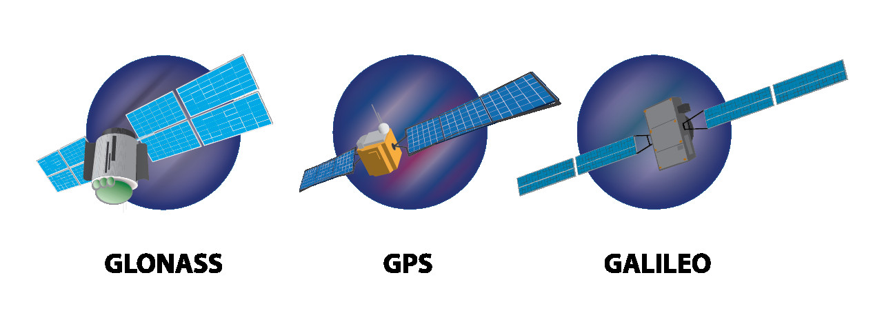
The difference between GPS and GNSS lies in their scope and origin. GPS (Global Positioning System) is a specific satellite navigation system developed and operated by the United States. GNSS (Global Navigation Satellite System) is a broader term that encompasses all global satellite navigation systems, including GPS, GLONASS (Russia), Galileo (Europe), and BeiDou (China). According to the European GNSS Agency (GSA), GNSS receivers can use signals from multiple satellite systems simultaneously, providing improved accuracy, reliability, and availability compared to GPS-only receivers. GNSS represents a global framework for satellite navigation, while GPS is a specific component within that framework.
6.2 How Does GLONASS Compare to GPS in Terms of Performance and Coverage?
GLONASS (Global Navigation Satellite System), developed by Russia, offers comparable performance and coverage to GPS. According to a study by the Russian Space Systems, GLONASS provides global coverage with a constellation of satellites orbiting the Earth.
 Diagram
While GPS satellites use Code Division Multiple Access (CDMA) technology, GLONASS uses Frequency Division Multiple Access (FDMA), resulting in differences in signal structure and performance. In terms of accuracy, GLONASS and GPS are generally comparable, with both systems capable of providing precise positioning data. However, GLONASS may offer better performance in high-latitude regions due to its satellite orbital design. GNSS receivers that can utilize both GPS and GLONASS signals can achieve improved accuracy and reliability, particularly in challenging environments.
6.3 What Are the Benefits of Using Multi-GNSS Receivers?
Multi-GNSS receivers offer several benefits over GPS-only receivers. According to a report by the International GNSS Service (IGS), these benefits include:
- Improved Accuracy: By utilizing signals from multiple satellite systems (e.g., GPS, GLONASS, Galileo, BeiDou), multi-GNSS receivers can achieve more precise positioning data.
- Increased Availability: Multi-GNSS receivers can access a larger number of satellites, improving signal availability in challenging environments, such as urban canyons and forested areas.
- Enhanced Reliability: The redundancy provided by multiple satellite systems reduces the risk of service disruptions due to satellite outages or signal interference.
- Faster Acquisition Times: Multi-GNSS receivers can acquire satellite signals more quickly, resulting in faster time-to-first-fix (TTFF).
- Better Performance in High-Latitude Regions: GLONASS, in particular, offers better performance in high-latitude regions compared to GPS, making multi-GNSS receivers ideal for applications in these areas.
Multi-GNSS receivers provide enhanced positioning capabilities, making them valuable for a wide range of applications, from navigation to surveying.
7. What Is the Future of GPS Technology?
The future of GPS technology involves advancements in accuracy, integration with other technologies, and expansion into new applications, promising more precise and ubiquitous positioning services.
7.1 How Are Accuracy and Reliability Being Improved in Modern GPS Systems?
Accuracy and reliability in modern GPS systems are being improved through several advancements. According to the National Coordination Office for Space-Based Positioning, Navigation, and Timing, these include:
- Satellite Upgrades: New generations of GPS satellites are equipped with more accurate atomic clocks and improved signal designs, enhancing positioning precision.
- Ground Infrastructure Enhancements: Upgrades to the GPS ground control system enable more precise monitoring and correction of satellite orbits and clock errors.
- Augmentation Systems: Satellite-based augmentation systems (SBAS), such as WAAS (Wide Area Augmentation System) in the United States, provide real-time corrections to GPS signals, improving accuracy and reliability.
- Multi-GNSS Integration: Combining GPS with other global navigation satellite systems (e.g., GLONASS, Galileo, BeiDou) increases the number of available satellites, improving signal availability and accuracy, particularly in challenging environments.
- Advanced Signal Processing Techniques: Innovative signal processing algorithms are being developed to mitigate the effects of multipath interference and atmospheric disturbances, further enhancing accuracy and reliability.
These advancements are paving the way for more precise and dependable GPS services, supporting a wide range of applications.
7.2 What Is the Role of A-GPS (Assisted GPS) in Enhancing GPS Performance?
A-GPS (Assisted GPS) plays a crucial role in enhancing GPS performance, especially in mobile devices. According to a report by Qualcomm, A-GPS improves GPS performance by:
- Faster Time-to-First-Fix (TTFF): A-GPS uses cellular network data to provide the GPS receiver with initial information about satellite locations, significantly reducing the time it takes to acquire satellite signals and determine the user’s position.
- Improved Sensitivity: A-GPS enhances the sensitivity of GPS receivers, enabling them to acquire signals in weak signal environments, such as indoors or in urban canyons.
- Reduced Power Consumption: By assisting the GPS receiver in acquiring signals more quickly, A-GPS reduces the amount of time the receiver needs to be active, leading to lower power consumption and longer battery life.
- Better Accuracy: A-GPS can provide additional information, such as cellular tower locations, to improve the accuracy of GPS positioning, particularly in areas where satellite signals are limited.
A-GPS is an essential technology for enhancing the performance of GPS in mobile devices, enabling faster, more accurate, and more reliable positioning services.
7.3 How Is GPS Being Integrated with Other Technologies Like IoT and 5G?
GPS is being increasingly integrated with other technologies like IoT (Internet of Things) and 5G to enable new applications and services. According to a report by Ericsson, the integration of GPS with IoT and 5G offers several benefits:
- Enhanced Location-Based Services: Combining GPS with IoT devices enables a wide range of location-based services, such as asset tracking, smart city applications, and precision agriculture.
- Improved Navigation and Mapping: Integrating GPS with 5G networks enables more accurate and real-time navigation and mapping services, supporting autonomous vehicles and drone delivery systems.
- Enhanced Emergency Response: Combining GPS with 5G networks enables faster and more accurate emergency response services, allowing first responders to quickly locate and reach individuals in distress.
- New Business Models: The integration of GPS with IoT and 5G is creating new business models and revenue opportunities, such as location-based advertising, geofencing, and remote monitoring services.
The integration of GPS with IoT and 5G is transforming industries and enabling a new era of connected and location-aware applications and services.
8. What Are Some Real-World Applications of GPS Technology?
GPS technology has various real-world applications, including navigation, surveying, agriculture, transportation, and public safety, improving efficiency and safety across these sectors.
8.1 How Is GPS Used in Modern Surveying and Mapping?
GPS is extensively used in modern surveying and mapping to achieve high precision and efficiency. As detailed by the National Geodetic Survey (NGS), GPS technology enables surveyors to:
- Establish Control Points: GPS is used to establish highly accurate control points, which serve as reference points for mapping and surveying projects.
- Conduct Topographic Surveys: GPS-equipped rovers are used to collect elevation and positional data, creating detailed topographic maps of terrain.
- Perform Boundary Surveys: GPS is used to accurately determine property boundaries and resolve boundary disputes.
- Monitor Land Deformation: GPS is used to monitor land deformation, such as subsidence and landslides, providing valuable data for hazard assessment and mitigation.
- Create Geographic Information Systems (GIS): GPS data is integrated with GIS software to create detailed maps and spatial databases for urban planning, resource management, and environmental monitoring.
GPS technology has revolutionized surveying and mapping, making it faster, more accurate, and more cost-effective.
8.2 What Role Does GPS Play in Precision Agriculture?
GPS plays a vital role in precision agriculture, enabling farmers to optimize crop production and resource management. According to the PrecisionAg Institute, GPS technology enables farmers to:
- Guidance and Steering: GPS-guided tractors and harvesters provide precise steering and guidance, reducing overlap and skips, and improving efficiency.
- Variable Rate Application: GPS-based variable rate applicators adjust the application of fertilizers, pesticides, and herbicides based on real-time data, optimizing resource use and minimizing environmental impact.
- Yield Monitoring: GPS-equipped yield monitors collect data on crop yield, moisture content, and other parameters, providing valuable insights for optimizing farming practices.
- Soil Mapping: GPS is used to create detailed soil maps, which are used to guide fertilizer application, irrigation, and other management practices.
- Automated Irrigation: GPS-based irrigation systems automatically adjust water application based on real-time weather data and soil moisture levels, conserving water and improving crop yields.
GPS technology is transforming agriculture, making it more efficient, sustainable, and profitable.
8.3 How Is GPS Technology Used in the Transportation and Logistics Industry?
GPS technology is integral to the transportation and logistics industry, enabling efficient fleet management, route optimization, and real-time tracking. According to a report by the American Trucking Associations (ATA), GPS technology allows transportation and logistics companies to:
- Track Vehicle Location: GPS trackers provide real-time information on the location of vehicles, enabling dispatchers to monitor fleet movements and respond quickly to changing conditions.
- Optimize Routes: GPS-based navigation systems provide drivers with optimal routes, reducing travel time, fuel consumption, and emissions.
- Monitor Driver Behavior: GPS-equipped devices monitor driver behavior, such as speeding, hard braking, and idling, promoting safety and reducing fuel costs.
- Improve Delivery Efficiency: GPS tracking enables companies to optimize delivery schedules, reduce delays, and improve customer service.
- Manage Inventory: GPS tracking is used to monitor the movement of goods and materials, improving inventory management and reducing losses.
GPS technology is revolutionizing the transportation and logistics industry, making it more efficient, safe, and sustainable.
9. How Can You Choose the Right GPS Device for Your Needs?
Selecting the right GPS device involves evaluating your specific needs, considering factors like accuracy requirements, environmental conditions, and intended use, ensuring optimal performance.
9.1 What Factors Should You Consider When Choosing a GPS Device for Outdoor Activities?
When choosing a GPS device for outdoor activities, several factors should be considered to ensure it meets your needs. According to experts at REI, a leading outdoor retailer, these factors include:
- Durability: Look for a rugged and waterproof device that can withstand the rigors of outdoor use.
- Battery Life: Choose a device with long battery life to ensure it lasts for the duration of your activities.
- Display Size and Clarity: Select a device with a clear and easy-to-read display, even in bright sunlight.
- Mapping Capabilities: Consider the type of maps you need, such as topographic maps, trail maps, or marine charts, and choose a device that supports them.
- Navigation Features: Look for features such as waypoint tracking, route planning, and compass integration to help you navigate effectively.
- Connectivity: Consider whether you need features such as Bluetooth or Wi-Fi connectivity for downloading maps or sharing data.
Choosing the right GPS device for outdoor activities can enhance your experience and ensure you stay safe and on course.
9.2 How Do You Evaluate GPS Accuracy for Professional Applications?
Evaluating GPS accuracy for professional applications requires careful consideration of several factors. According to a guide by Trimble, a leading provider of surveying and mapping equipment, these factors include:
- Accuracy Specifications: Review the device’s accuracy specifications, such as horizontal and vertical accuracy, to ensure they meet your requirements.
- Differential Correction: Consider using differential correction techniques, such as real-time kinematic (RTK) or post-processing, to improve accuracy.
- Satellite Visibility: Ensure that the device has good satellite visibility in your work area, as obstructions can reduce accuracy.
- Atmospheric Conditions: Be aware of atmospheric conditions, such as ionospheric and tropospheric delays, which can affect GPS accuracy.
- Calibration and Maintenance: Regularly calibrate and maintain your GPS equipment to ensure it is performing optimally.
- Testing and Validation: Conduct field tests to validate the accuracy of your GPS data and identify any potential issues.
Properly evaluating GPS accuracy is essential for ensuring reliable and precise results in professional applications.
9.3 What Are the Key Features to Look for in a GPS Tracker for Vehicles?
When selecting a GPS tracker for vehicles, several key features should be considered to ensure it meets your tracking needs. According to a guide by GPS.gov, these features include:
- Real-Time Tracking: The ability to track the vehicle’s location in real-time, providing up-to-the-minute information on its whereabouts.
- Geofencing: The ability to set up virtual boundaries and receive alerts when the vehicle enters or exits a designated area.
- Historical Data: The ability to store and review historical tracking data, providing insights into vehicle usage and patterns.
- Alerts and Notifications: The ability to receive alerts for speeding, harsh braking, unauthorized use, and other events.
- Remote Immobilization: The ability to remotely disable the vehicle’s engine in the event of theft or unauthorized use.
- Battery Life: Long battery life to ensure continuous tracking, even when the vehicle’s engine is turned off.
- Easy Installation: Simple and easy installation, allowing you to quickly deploy the tracker in your vehicles.
Choosing a GPS tracker with the right features can help you improve fleet management, enhance security, and reduce costs.
10. How Has GPS Technology Evolved Over Time?
GPS technology has evolved significantly, from its origins in military applications to its widespread use in civilian sectors, driven by advancements in satellite technology, signal processing, and receiver design.
10.1 What Were the Original Goals and Purposes of GPS Development?
The original goals and purposes of GPS development were primarily military. According to the U.S. Department of Defense, GPS was developed to:
- Improve Navigation: Provide accurate and reliable navigation capabilities for military forces, enabling them to operate in any weather conditions and anywhere in the world.
- Enhance Targeting: Improve the accuracy of weapon systems, allowing for more precise targeting and reduced collateral damage.
- Coordinate Military Operations: Facilitate the coordination of military operations by providing a common reference point for all units.
- Support Search and Rescue: Assist in search and rescue missions by providing accurate location data for downed aircraft and stranded personnel.
- Improve Situational Awareness: Enhance situational awareness by providing real-time information on the location of friendly and enemy forces.
GPS was initially a classified military project, but it was later made available for civilian use, transforming navigation and positioning across various sectors.
10.2 How Did the Transition from Military to Civilian Use Impact GPS Technology?
The transition from military to civilian use had a profound impact on GPS technology. According to a report by the National Research Council, this transition:
- Stimulated Innovation: The availability of GPS for civilian use spurred innovation in receiver design, signal processing, and applications development.
- Expanded Market Opportunities: The civilian market for GPS devices and services grew rapidly, creating new business opportunities and driving down costs.
- Increased Accessibility: GPS technology became more accessible to the general public, leading to its widespread adoption in navigation, mapping, and other applications.
- Fueled Economic Growth: The civilian use of GPS contributed to economic growth by improving efficiency, productivity, and safety in various sectors.
- Promoted International Cooperation: The success of GPS led to the development of other global navigation satellite systems (GNSS), fostering international cooperation in space-based positioning, navigation, and timing.
The transition from military to civilian use transformed GPS technology from a specialized tool for military forces to a ubiquitous technology that has revolutionized navigation and positioning worldwide.
10.3 What Are Some Key Milestones in the History of GPS Technology?
Several key milestones mark the history of GPS technology. According to the U.S. Space Force, these milestones include:
| Year | Milestone |
|---|---|
| 1973 | The U.S. Department of Defense authorizes development of GPS. |
| 1978 | The first GPS satellite is launched. |
| 1983 | President Ronald Reagan makes GPS available for civilian use. |
| 1993 | The GPS constellation reaches full operational capability. |
| 2000 | Selective Availability (SA) is discontinued, improving GPS accuracy. |
| 2020 | Modernized GPS satellites with improved signals are deployed. |
These milestones represent significant achievements in the development and deployment of GPS technology, transforming navigation and positioning worldwide.
Explore pioneer-technology.com for more insights into the evolution and applications of GPS technology. Discover how GPS continues to shape our world and revolutionize industries.
Interested in learning more about the latest advancements in GPS technology and how they can benefit your business or personal life? Visit pioneer-technology.com today to explore our comprehensive collection of articles, product reviews, and expert insights. Stay ahead of the curve and discover the future of navigation and positioning with pioneer-technology.com!
Address: 450 Serra Mall, Stanford, CA 94305, United States. Phone: +1 (650) 723-2300. Website: pioneer-technology.com.
FAQ: What Is GPS Technology?
1. What exactly is GPS technology?
GPS technology is a satellite-based navigation system providing location and time information worldwide. It functions in all weather conditions, using a network of satellites to pinpoint the position of a GPS receiver.
2. How does GPS technology work to determine my location?
GPS technology uses a process called trilateration. A GPS receiver measures the distance from at least four satellites and calculates its position by determining where those distances intersect.
3. What are the essential components of the GPS system?
The three essential components of the GPS system are the satellites orbiting Earth, ground control stations that monitor the satellites, and user equipment such as smartphones and GPS devices that receive signals.
4. How accurate is GPS technology in everyday use?
GPS accuracy typically ranges from 5 to 10 meters in open areas. Accuracy can be affected by obstructions like buildings, atmospheric conditions, and the quality of the GPS receiver.
5. Can weather conditions affect the performance of GPS technology?
Yes, weather conditions can affect GPS performance. Heavy cloud cover, atmospheric disturbances, and solar activity can weaken or distort GPS signals, reducing accuracy.
6. What are some common applications of GPS technology?
Common applications of GPS technology include navigation in vehicles, mapping and surveying, tracking assets and vehicles, precision agriculture, and emergency response services.
7. Is GPS technology the only global navigation system available?
No, GPS is not the only global navigation system. Other systems include GLONASS (Russia), Galileo (Europe), and BeiDou (China). These systems, collectively known as GNSS, offer improved accuracy and reliability when used together.
8. How does A-GPS improve the performance of GPS technology on smartphones?
A-GPS, or Assisted GPS, uses cellular network data to provide initial satellite information to the GPS receiver, enabling faster signal acquisition, improved sensitivity, and reduced power consumption on smartphones.
9. Are there any limitations or security concerns associated with GPS technology?
Limitations of GPS technology include signal interference, accuracy issues in urban areas, and reliance on satellite infrastructure. Security concerns involve potential hacking and spoofing of GPS signals.
10. How is GPS technology being integrated with other technologies like IoT and 5G?
GPS technology is being integrated with IoT and 5G to enable enhanced location-based services, improved navigation, and new applications such as smart cities, asset tracking, and autonomous vehicles, leveraging the speed and connectivity of these technologies.