Embark on an enriching nature walk at Pioneer Park in Tumwater, Washington, and explore the fascinating ecosystem of the Deschutes River. This guide will lead you through the park’s scenic river trail, highlighting key ecological features and points of interest, perfect for families and nature enthusiasts alike.
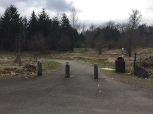 Pioneer Park Trail Entrance in Tumwater, WA
Trailhead and First Glimpse of the River
As you enter the Pioneer Park parking lot, the river trail entrance is conveniently located to your left. A young grove of Douglas fir trees marks the beginning of your riverside journey. Please stay on the designated main trail to respect private property boundaries; the side trail under the bridge is off-limits.
Take a moment to observe the Deschutes River. Notice its width and the speed of its current. Historically, rivers like the Deschutes flowed freely, meandering across the landscape on their path to the sea. This natural meandering process is crucial for a healthy river ecosystem. Unfortunately, many rivers worldwide are now constrained by dikes and dams, altering their natural flow.
Learn more about the importance of free-flowing rivers:
- American Rivers: Discover Your River – River Anatomy
- National Geographic: Understanding Rivers
- World Wildlife Fund: Free-Flowing Rivers
The Deschutes River, like other lowland South Sound streams, is primarily rain-dominant. This means its flow is dictated by rainfall rather than snowmelt, setting it apart from streams influenced by snowpack. During winter and early spring, expect the Deschutes to exhibit its most powerful flow, with deeper and faster waters.
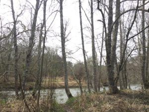 Red Alder Trees along Deschutes River Trail in Pioneer Park, Tumwater
Following the River’s Course
Take the gravel path to your right and begin following the Deschutes River downstream, observing the direction of its flow. Imagine tracing this river all the way to its endpoint – it journeys into Capitol Lake, passes through a dam, under the 5th Avenue bridge in Olympia, and finally merges with the saltwater of Budd Inlet in Puget Sound.
Along the riverbanks, look for deciduous trees, easily identifiable by their leaves. Red alders and black cottonwoods are the predominant species here. These trees are well-adapted to wet soil conditions, making them ideal for riverside habitats. They play a vital ecological role by providing shade for the river, creating habitats for birds, insects, and other wildlife, and enriching the soil with nutrients.
As you walk, you might notice sections of the riverbank reinforced with rip-rap – large boulders placed along the river’s edge. This rip-rap was likely installed during the land’s agricultural past or after a significant flood event to create a levee and prevent the river from overflowing its banks. This construction, however, would have removed the original vegetation. While red alders and cottonwoods are among the first to re-establish in disturbed areas, non-native plants often quickly colonize, outcompeting native shrubs and groundcover. This altered understory, unfortunately, offers less suitable shelter and food sources for local wildlife.
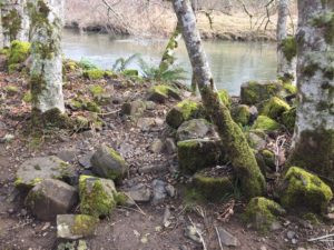 Rip-Rap along the Deschutes Riverbank at Pioneer Park in Tumwater
Riparian Revegetation and Wildlife Habitat
Keep an eye out for a large sign detailing an Eagle Scout’s riparian restoration project. This sign provides insights into efforts to restore the natural riverbank ecosystem.
Consider the types of wildlife that would thrive in this habitat. Listen for birdsong, watch for garter snakes basking in the sun, and be alert for the scurrying of small mammals. Pioneer Park’s riparian zone supports a diverse array of creatures, including various bird species, garter snakes, mice, raccoons, butterflies, and even deer.
Understanding Riparian Areas: Riparian areas are the transitional zones between land and water bodies like rivers and streams. These areas are characterized by unique soil conditions and vegetation types that are directly influenced by the presence of water. The vegetation in riparian zones is critical for maintaining healthy stream banks, preventing erosion, mitigating flood impacts, and providing shade to keep the water cool. These vegetated corridors are known as riparian zones.
For more in-depth information on riparian areas, refer to this resource from the Washington State Department of Ecology: Focus on Riparian Areas.
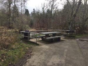 Picnic Bench Overlooking Deschutes River at Pioneer Park, Tumwater
Junction and Man-Made Interventions
As you reach a junction with a paved path, turn right and head back towards the parking lot, staying left on the paved path. Near the picnic table, take another look at the riverbank.
Can you identify man-made structures along the riverbank? The large rock wall you see is more rip-rap. Rip-rap is frequently used in areas where natural vegetation has been removed to protect against bank erosion. When high water strikes the rip-rap, the force is deflected, minimizing soil erosion.
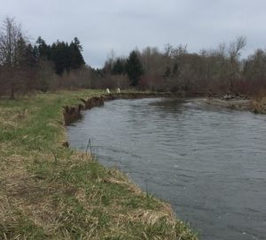 Riverbank Erosion on the Deschutes River at Pioneer Park in Tumwater
Observing Riverbank Erosion
Near the parking lot again, turn left onto the wide gravel path, and continue straight, past the life jacket sign.
Upon returning to the river’s edge, look both upstream and downstream. Can you spot areas where the riverbanks are collapsing or falling into the water? Please maintain a safe distance from the bank as the river is swift and deep here. The erosion you observe is likely exacerbated by the historical removal of native trees and shrubs along the Deschutes River. The root systems of these plants would have naturally reinforced the soil, and overhanging foliage would have lessened the impact of the water’s force. Recognizing this, many landowners, local agencies, and volunteer groups are actively involved in riparian restoration projects, replanting native vegetation to combat erosion.
What happened to the native shrubs and groundcover that once flourished along the Deschutes? Land use changes, such as farming, likely led to the clearing of trees from these banks. Without tree cover, riverbanks become more vulnerable to erosion, especially during flood events. Trees are essential for slowing down floodwaters and their roots act as natural anchors, holding soil in place and reducing erosion.
Erosion is a natural process in a healthy stream system, occurring gradually over time. It plays a role in shaping the streambed and providing gravel and rock needed for fish spawning habitats. However, human interference, such as removing riverside trees, can accelerate erosion, leading to excessive sediment in the water and unnatural widening of the riverbanks. Pioneer Park serves as a clear example of why riparian restoration is so critical, and this location would greatly benefit from further tree planting initiatives.
Congratulations on Completing Your Exploration!
You’ve now completed your nature walk and observation of stream bank erosion along the Deschutes River at Pioneer Park in Tumwater!
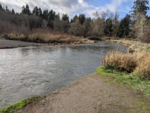 Pioneer Park Sticker Reward after Deschutes River Trail Exploration
To return to the parking lot, continue following the path and turn right at the gravel intersection, retracing your steps. We hope you enjoyed discovering the natural beauty and ecological lessons at Pioneer Park in Tumwater!
