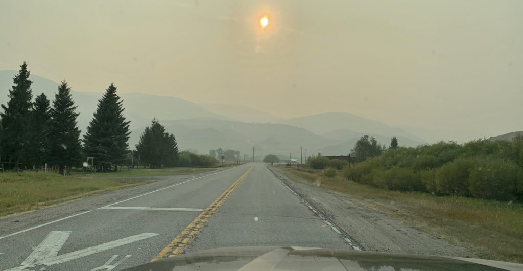
In the vast expanse of the American West, where wildfires painted smoky hazes across the skies in late summer 2020, finding a haven of fresh air and tranquility felt like striking gold. For those seeking refuge and adventure, Southwest Montana’s Pioneer Mountains emerged as an ideal destination. The allure? Fewer crowds, promising weather, and the chance to escape the choking smoke that blanketed much of the West Coast. Our journey led us directly to the heart of this unspoiled region: the Pioneer Mountains Scenic Byway, a route that unveiled the raw and rugged beauty of Montana.
 Campsite view in the Pioneer Mountains, Montana
Our exploration of the Pioneer Mountains unfolded along the celebrated Pioneer Mountains Scenic Byway, a 49-mile paved road nestled within the Beaverhead-Deerlodge National Forest. This route, a treasure for outdoor enthusiasts, carves through the Pioneer Mountain Range, where granite peaks ascend to heights over 10,000 feet. This byway is more than just a drive; it’s an invitation to immerse yourself in a diverse landscape offering camping, hiking, horseback riding, premier fishing and hunting locales, historical landmarks, unique rock hounding opportunities, rejuvenating hot springs, and even a local ski resort. Unlike the bustling trails of Glacier National Park, the Pioneers offer a serene mountain experience, making the Pioneer Mountains Scenic Byway in Montana a truly unique and quieter escape.
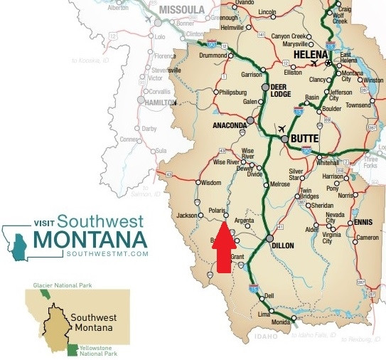 Map of Southwest Montana highlighting the Pioneer Mountain Byway route
Designated a scenic byway in 1989, the Pioneer Mountains Scenic Byway stretches southward from State Highway 43 near Wise River to State Highway 278, positioned between Dillon and Jackson. It’s important to note that a portion of the byway, from Pettingill parking lot to Elkhorn Hot Springs, is seasonally closed from December 1st to May 15th. Its manageable length makes it perfect for a fulfilling day trip, while the nine well-maintained Forest Service campgrounds along the byway beckon for longer stays amidst the Montana wilderness.
Camping Along Pioneer Mountains Scenic Byway
For those eager to extend their adventure, the Pioneer Mountains Scenic Byway boasts a selection of Forest Service campgrounds catering to both tent campers and RV travelers. As you journey from north to south along the byway, you’ll encounter a variety of camping options. These include Pettengill Campground, Fourth of July Campground, Lodgepole Campground, Boulder Creek Campground, Willow Campground, Little Joe Campground, Mono Creek Campground, Price Creek Campground, and Grasshopper Campground.
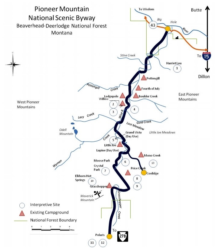 Pioneer Mountain Byway map showcasing campgrounds and points of interest
For tent camping and smaller RVs, Willow, Little Joe, and Mono Creek campgrounds are particularly recommended. Most other campgrounds, excluding Pettengill, can comfortably accommodate larger setups, including combinations as long as 51 feet. However, for exceptionally long RVs, it’s advisable to consult with the Wise River Ranger Station to confirm campground suitability. While we missed the opportunity to explore Pettengill Campground, feedback from fellow campers is always welcome!
During our visit, we chose Boulder Creek Campground. Its appeal lay in the combination of ample shade and sufficient sunlight for our solar panels. We also appreciated the quieter atmosphere compared to the more popular Lodgepole Campground, though Lodgepole’s riverside sites along the Wise River are undeniably attractive. Boulder Creek provided us with a convenient pull-through site overlooking the river, albeit without direct river access. The campground featured paved access roads and sites, each equipped with a picnic table and fire pit. Potable water was available via a hand pump, and pit toilets were provided. The nightly cost was a reasonable $8, a testament to the accessible adventures along the Pioneer Mountains Scenic Byway in Montana.
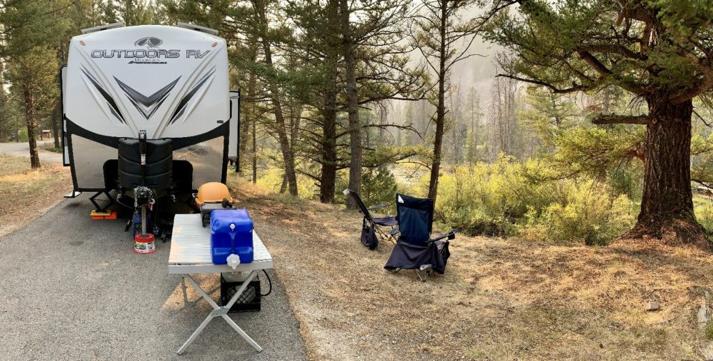 Camping setup at Boulder Creek Campground in the Pioneer Mountains
Beyond the established campgrounds, the Pioneer Mountains Scenic Byway is dotted with numerous appealing dispersed campsites, offering free dry camping opportunities. For future visits, we intend to explore these more rustic options, but Boulder Creek Campground proved to be an excellent introduction to camping along this Montana scenic byway.
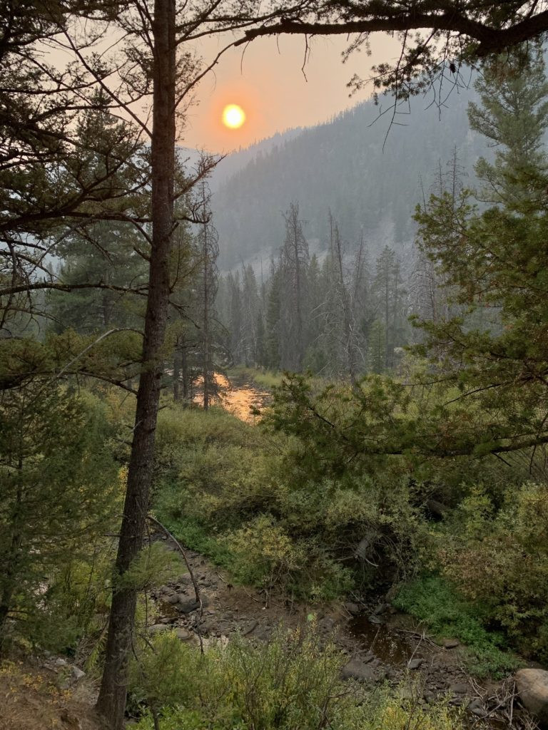 Smoky sunset view from a campsite in the Pioneer Mountains
A practical tip for visitors: ensure you are well-stocked with supplies and fuel before venturing deep into the Pioneers. The Wise River Mercantile offers basic essentials, but diesel is not available at their pumps, which are the only ones in town. Cell service and Wi-Fi connectivity are extremely limited in this area. The Wise River Ranger Station parking lot offered the strongest Verizon signal we could find, highlighting the remote and unplugged nature of the Pioneer Mountains Scenic Byway experience.
Hiking Adventures in the Pioneer Mountains
The Pioneer Mountains are a hiker’s paradise, brimming with trails that promise breathtaking vistas and immersion in Montana’s wilderness. Many trailheads are conveniently accessible directly from the Pioneer Mountains Scenic Byway, while others can be reached via I-15 to the east. Our ambitious hiking plans included exploring several high mountain lake trails, but smoke from distant wildfires unfortunately impacted visibility during our chosen hikes. Despite the smoky conditions, we managed to experience two trails, confirming the stunning beauty that awaits on clearer days.
 Sawtooth Lake hike in the Pioneer Mountains under smoky skies
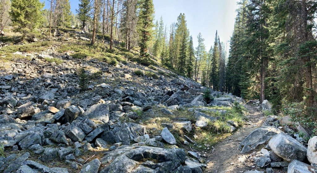
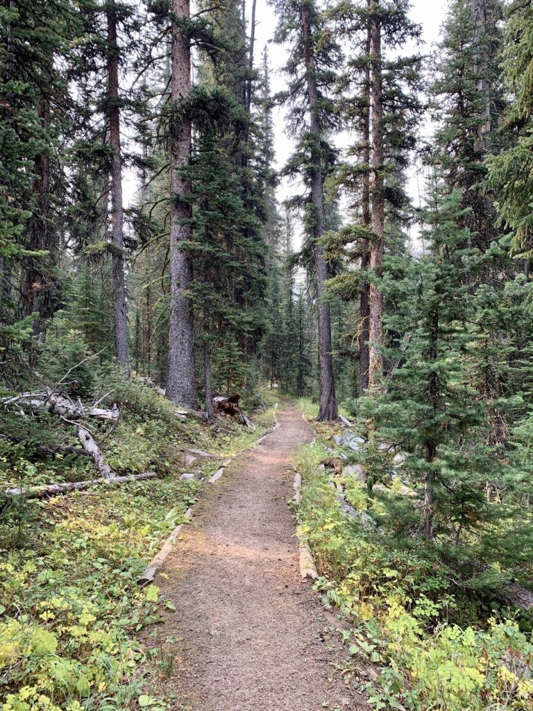
Our first hike was to Sawtooth Lake. From Boulder Creek Campground, we traveled south on the Pioneer Mountains Scenic Byway, past the turnoff for Maverick Mountain Ski Area. East on Clark Creek Road, well-placed signs guided us to the trailhead. The Sawtooth Lake trail impressed us with its excellent maintenance, save for a section with recent fallen trees. The initial ascent led us through a young lodgepole pine forest, a testament to nature’s resilience after a 2003 fire. This section offered minimal shade. The middle portion of the hike was a delightful, relatively flat walk alongside Clark Creek through mature forest. The final climb to Sawtooth Lake was well-graded, rewarding us with glimpses of mountain views, though softened by the ever-present smoke.
 Scenic view along the Sawtooth Lake trail in the Pioneer Mountains
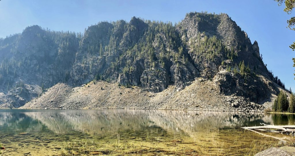
Sawtooth Lake, at an elevation of 8,523 feet, is a jewel nestled against a dramatic backdrop of towering peaks. Despite the smoke-muted views, the lake’s beauty was undeniable, solidifying our desire to return on a clearer day. The 7.8-mile hike with a 1,500-foot elevation gain was moderately challenging, and we encountered very few other hikers, enhancing the sense of wilderness solitude. For a moderate hike in the Pioneer Mountains, Sawtooth Lake is an excellent choice.
Our second hike took us to Grayling Lake. While geographically close to our campsite, reaching the Grayling Lake trailhead required a significant drive. The journey involved traveling north on the Pioneer Mountains Scenic Byway to Wise River, then east on Highway 43 to I-15, south to the Melrose exit, and finally 17 miles west on Trapper Creek Road (gravel) and Canyon Creek Road (dirt)—a true adventure in itself! Along the way, we made a stop at the intriguing Canyon Creek Charcoal Kilns, a historical site worthy of its own exploration.
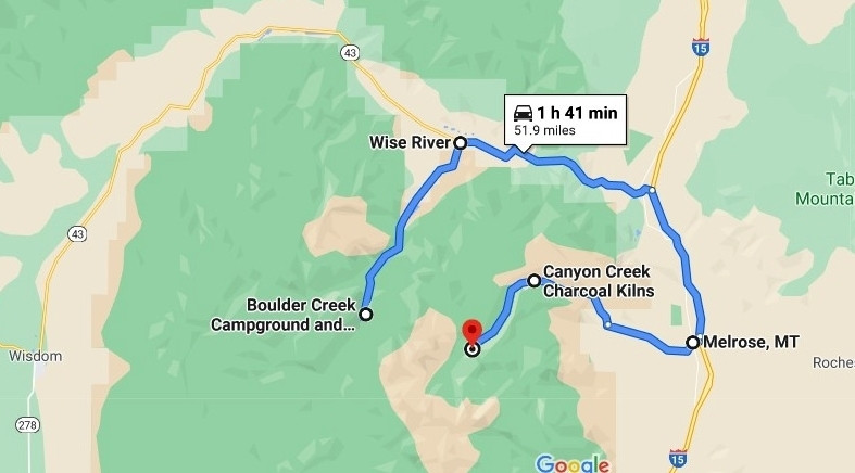 Map illustrating the longer route to Grayling Lake trailhead from the Pioneer Mountains Byway
Smoky conditions persisted upon our arrival at the Canyon Creek Trailhead, but we proceeded optimistically. The trail immediately crossed Canyon Creek via a sturdy footbridge, continuing into the forest with a gentle incline. Occasional breaks in the trees offered glimpses of imposing peaks, largely veiled by smoke. The eastern side of the Pioneers appeared lusher than the western slopes.
 Gravel road leading to Canyon Creek Trailhead for Grayling Lake hike
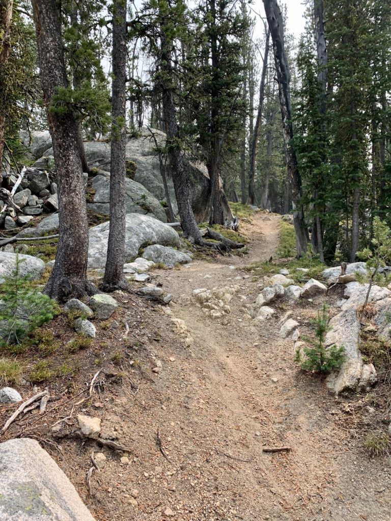
At 1.75 miles, a trail junction marked the way to Crescent Lake (a potential backpacking destination for the future). We took the Lion Creek Trail to the left, continuing our gradual ascent. The majority of the elevation gain came in the final miles, navigated via expertly crafted switchbacks. Viewpoints along the way hinted at the surrounding grandeur, but the thickening smoke limited our vistas.
 Switchbacks and forest scenery along the Grayling Lake trail
 Mountain scenery visible through the trees on the Grayling Lake hike
Grayling Lake, at 8,728 feet, was breathtaking. Smoke notwithstanding, we sensed we were in the presence of one of Montana’s most spectacular lakes. While Lion Lake, even higher and reputedly more stunning, beckoned, time constraints and the heavy smoke deterred us. Grayling Lake cemented our desire to return for a backpacking trip, and we savored a peaceful break at the lake’s outlet before our return hike. Despite the smoky haze, the Grayling Lake hike is highly recommended, provided you are prepared for the lengthy drive. Our 11.6-mile hike with 1,400 feet of elevation gain offered remarkable solitude, with only two other groups encountered. Backpacking in this area is firmly on our bucket list.
 Grayling Lake shrouded in smoke on a gray day in the Pioneer Mountains
As air quality worsened, we shifted our focus from hiking boots to historical exploration, another facet of the rich experience along the Pioneer Mountains Scenic Byway.
Beyond Hiking and Camping: Exploring Pioneer Mountains Byway
While camping and hiking highlighted our visit, the Pioneer Mountains Scenic Byway offers a wealth of other recreational opportunities:
 Scenic viewpoint along the Pioneer Mountains Byway before smoke haze
- Interpretive sites, overlooks, and picnic areas: The byway is thoughtfully dotted with well-signed locations perfect for leisurely stops and enjoying the panoramic views.
- Elkhorn Hot Springs: A privately owned “rustic getaway in the Grasshopper Valley” offering lodging, dining, and outdoor pools ranging from 92-102 degrees.
- Maverick Mountain Ski Resort: A “Montana local secret” renowned for its untouched powder, ideal for skiers seeking an authentic Montana ski experience.
- Crystal Park Mineral Collection Area: A Forest Service site along the byway where you can dig for quartz crystals for a small vehicle fee.
- Big Hole River fishing: Wise River provides river access and guided fishing trips for anglers eager to cast a line in Montana’s renowned waters.
Nearby Attractions: Extend Your Montana Adventure
Enhance your Pioneer Mountains Scenic Byway journey by exploring these nearby attractions:
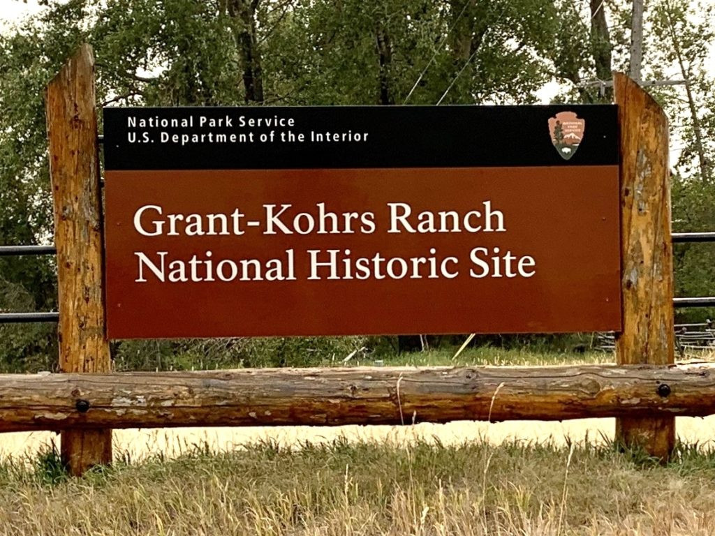 Historic buildings at Grant-Kohrs Ranch National Historic Site
 Memorial at Big Hole National Battlefield, Montana
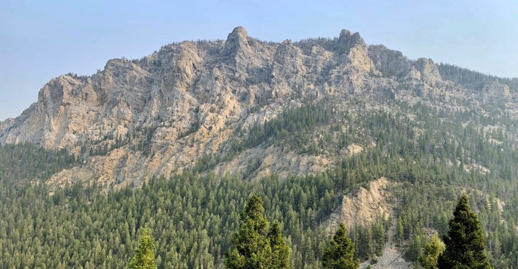
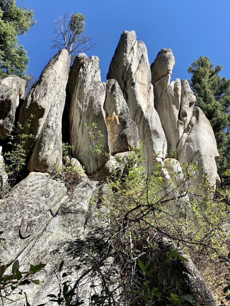 Unique rock formations at Humbug Spires State Park in Montana
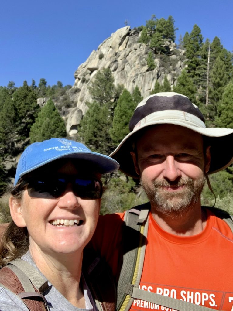 Hiking trail through the spires at Humbug Spires State Park
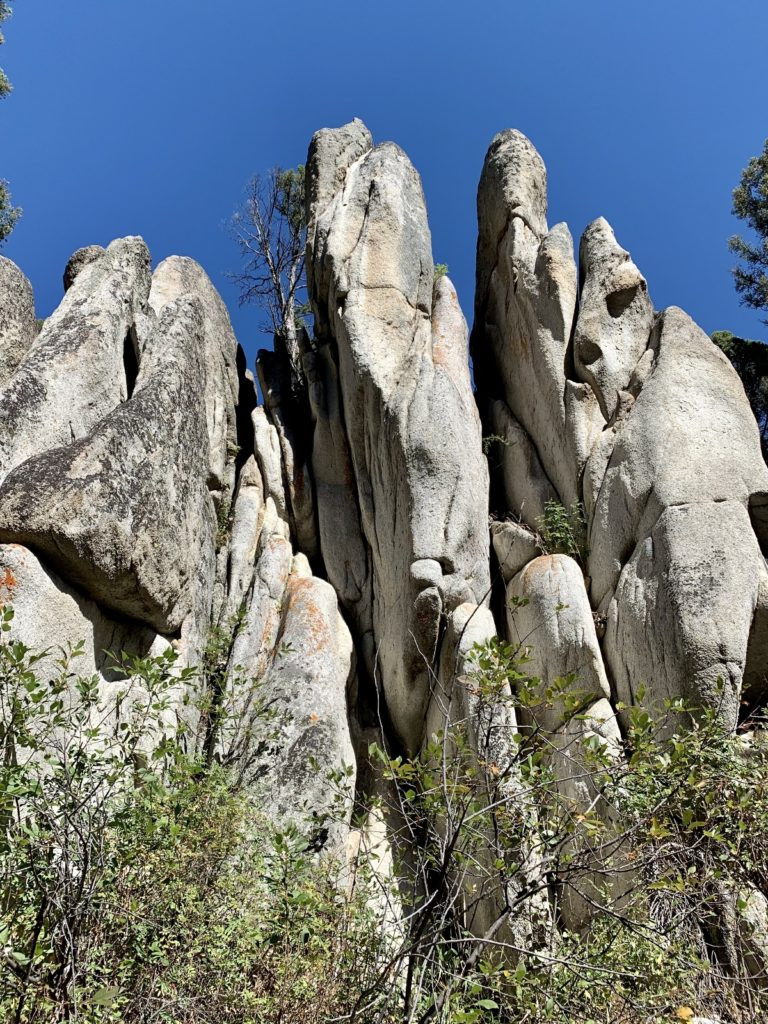 Close up of granite spires at Humbug Spires State Park
Resources
- The essential Forest Service brochure is a must-have for planning your Pioneer Mountains National Scenic Byway trip. Up-to-date conditions are readily available from the knowledgeable staff at the Wise River Ranger Station.
- Dillon and Butte serve as the closest full-service towns to the byway for more extensive supplies and services.
The Adventure Continues
Join us for our next installment, Montana’s Pioneer Mountains National Scenic Byway Part 2: Historical Sites, where we explore Coolidge Ghost Town and the Canyon Creek Charcoal Kilns, further enriching your Pioneer Mountains experience.